What is the scale (kilovoltage) of this project? How, when and where can the public view the ancillary planning documents related to this project?
Where is the power coming from? Where is it going to?
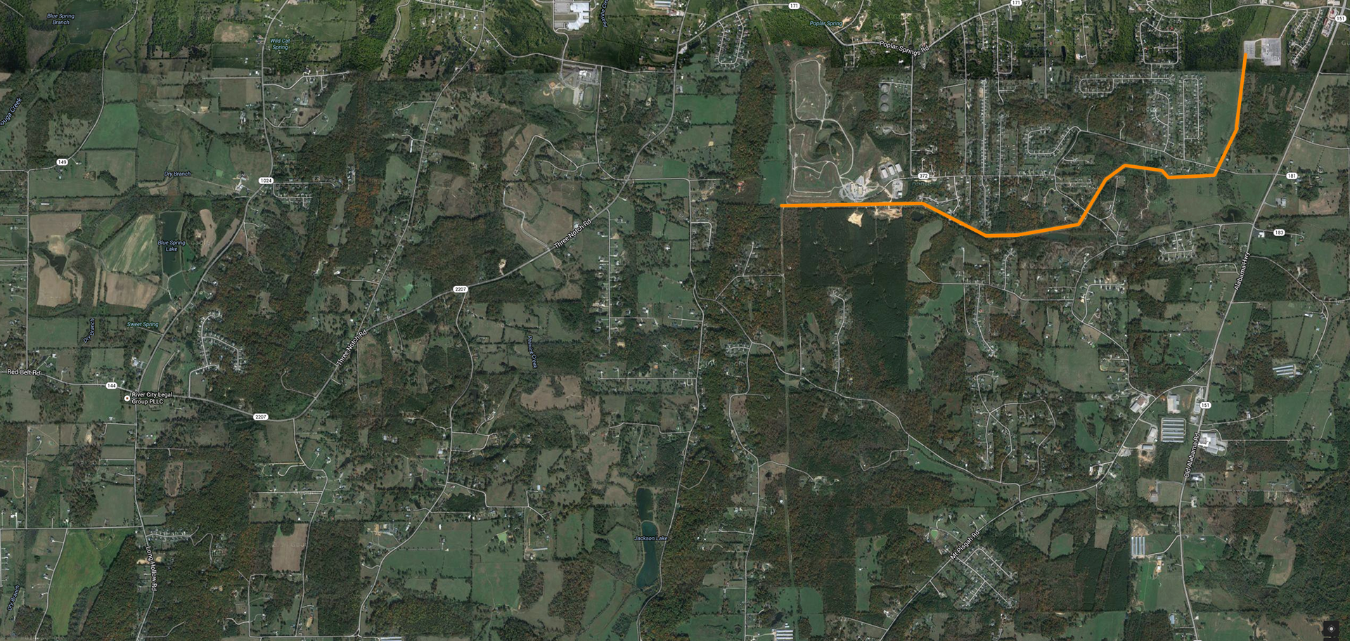
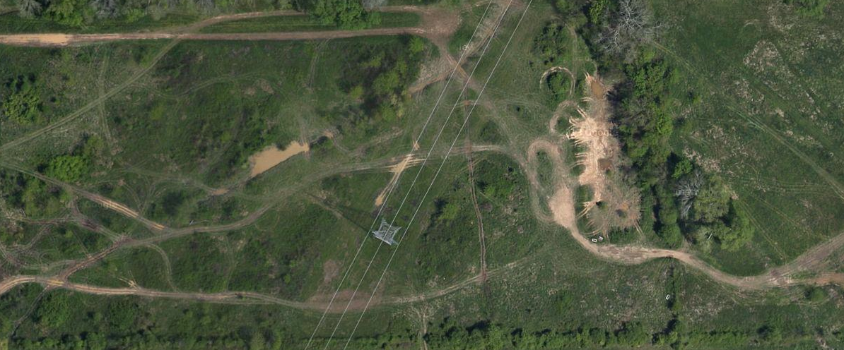
What is the project’s preferred path? What alternatives have been considered? It appears this is a westward extension of the transmission line from the West Ringgold substation on Alabama Highway, which currently ends at the county landfill. Clear cuts on Davis Ridge and along Three Notch Rd indicate a possible path.
Does this proposal require the use of eminent domain in order to acquire any right-of-way for this project? How many landowners or homeowners will be impacted by the use of eminent domain, what specific lands would be acquired and where are they located?
How has safe, renewable energy been factored into the mix for this expansion of the electric grid?
How would residents and property owners be protected from impacts to property values, property use, human health, environment, scenery, traffic congestion and other concerns?
Why does this area require a new substation and new transmission lines? Why can’t the substation be located at an industrial park? Why bring in power from other areas, when existing North Georgia Electric Membership Cooperative providers, electric infrastructure, corridors and lines could be used?
Oglethorpe Power recently brought 2 large plants online: Hammond (Rome) and Smith (Dalton). NGEMC has purchased power from TVA up to this point. Is this a move by Oglethorpe to expand its member system? Is NGEMC planning to switch from TVA to Oglethorpe as a provider?
We recognize that the country’s power grid is 50 years behind where it should be. How can we be sure this project is urgently needed and that it would be planned and executed in the best possible way?
The large residential and industrial areas this substation would serve are located on or over the Walker county line. Why can’t this substation be sited in Walker county? Why can’t it be located in an existing industrial zone, or abandoned/unproductive agricultural land? Why can’t transmission lines use the existing corridors?
Electricity Generation & Distribution Map (itoworld.com) →
The citizens of this immediate area have often objected to rezoning, inappropriate development, and inadequate infrastructure planning, but the county and state have (just as often) brushed off these objections. Politicians and officials have stated property values would remain steady, taxes would not increase, and infrastructure would be sufficient to support new development. Why should citizens believe the state and county governments?
This area is one of the last remaining sections of the county with large areas of productive farmland and pasture. If a substation is built, will it lead to rapid suburban development? Will there be large transmission towers and lines leading in all directions?
Why should citizens accept yet another assault on their cultural and property values? Why should they believe the politicians and officials who are supporting this project?
Why is this facility not planned for location on existing powerlines (expansion) or power corridors (co-location)? Why not choose an industrial location, or abandoned/unused agricultural parcels, instead of ruining prime, productive farmland and impacting a beautiful rural landscape?
With the nearby sinkholes and springs, how can the proposed site be stable and safe enough to support such a large facility? How can the state and utilities guarantee there will never be groundwater pollution, or further impairment to Chickamauga Creek, from an accident at the facility?
The roads in this area are not capable of handling additional traffic, and are not safe for motorists, pedestrians or cyclists. This area has seen too much sprawling residential development in the past, and it does not have the sidewalks, turning lanes, drainage or other amenities and infrastructure to handle additional development.
Economics may lead to this project failing to get built, or being unnecessary. Walker County wants to develop a huge industrial park, and more residential zones in Rock Spring and Kensington. They are now asking to raise citizens’ taxes, while simultaneously offering real estate and tax incentives to prospective employers and developers.
What proposed or planned development is contingent upon this new infrastructure? Who stands to financially benefit from the project (power producers, contractors and/or developers)?
Why should Catoosa citizens bear the external cost of this project? Will Catoosa and the state be hunting for tax increases as well? Why should current residents, landowners and citizens pay the bills for economic speculation by the counties and the state?
Image: Electricity Sub-Station; Sub-Station south of Maybole with transmission line running to the east
© Copyright Mary and Angus Hogg and licensed for reuse under this Creative Commons Licence.