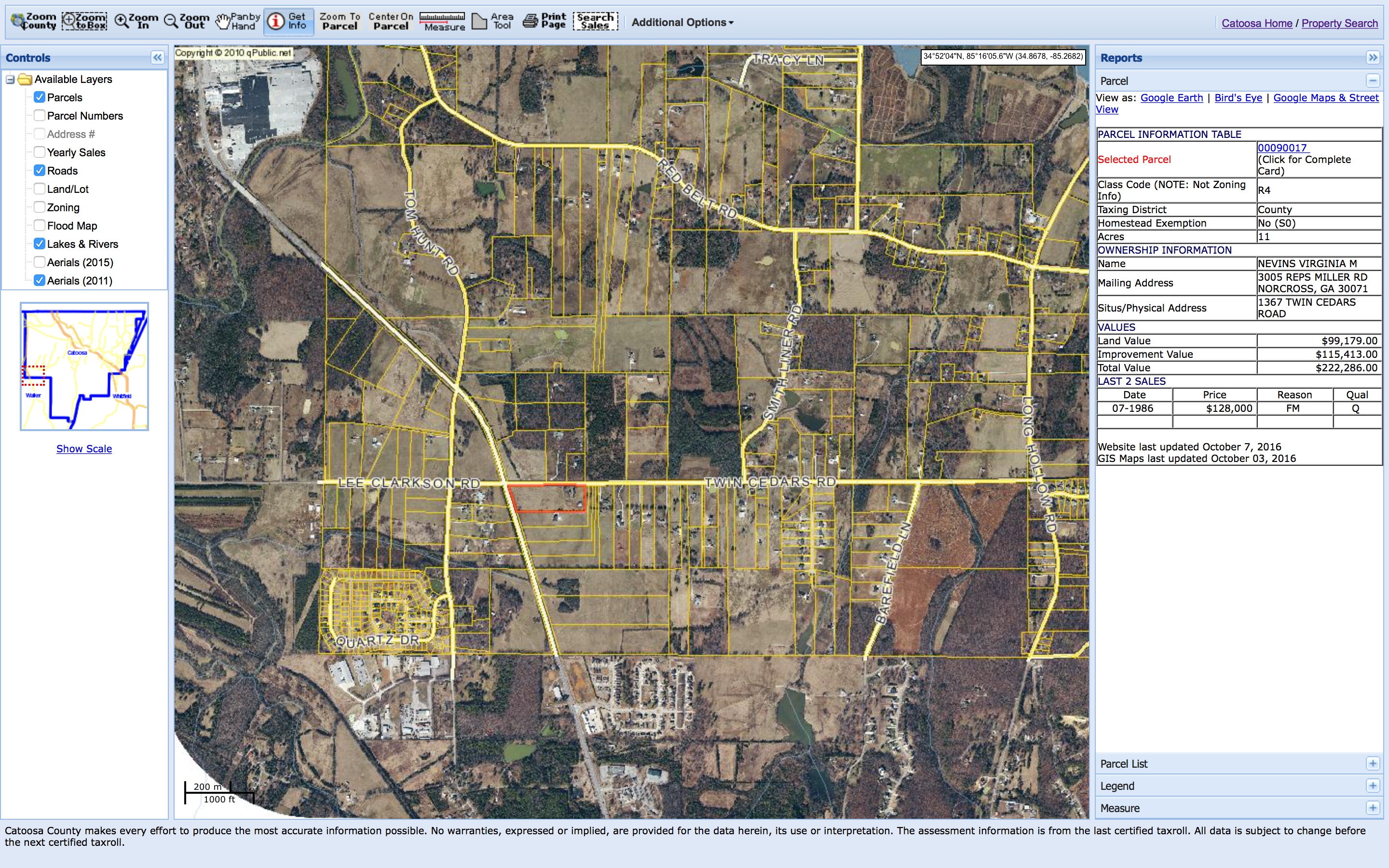
Catoosa County Planning Commission is considering a re-zoning and subdivision request for an 11 acre parcel on the southwest corner of Twin Cedars Rd and US Hwy 27. There is an additional plan for major reconstruction of the intersection, with turn lanes and traffic signals. None of this is favorable for local residents and property owners, nor is it necessary.
Zoning and Land Use of the Nevins parcel
County commercial land use and property zoning code is worded to favor promotion of intra-county commerce and residents’ convenience. There is no justification on those grounds for commercial development of the Nevins parcel. It is situated in an extreme corner of the county, with mainly agricultural and large residential parcels. Therefore, commercial development would not serve a large number of Catoosa residents.
Twin Cedars & US Hwy 27 area, showing the Nevins property
This corner of Catoosa can be thought of as “Watoosa,” because it is a remote corner of the county, surrounded and served by Walker County commercial and manufacturing zones.
Rock Spring, Ringgold, Chickamauga, Fort Oglethorpe and Lafayette are nearby towns that provide for any commercial need.
There are already multiple commercial and manufacturing zones serving the area (though most are in Walker): Fieldstone Farms has small retail, office and dining. Red Belt/27/Lafayette Rd is a large commercial zone with all commercial (retail, dining, lodging, office) and heavy manufacturing uses. Four Corners (Red Belt/Long Hollow/Burning Bush/Three Notch) has light manufacturing, multi-unit, and small retail.
Traffic Safety and Planning for Twin Cedars Rd and Lee Clarkson Rd at Hwy 27
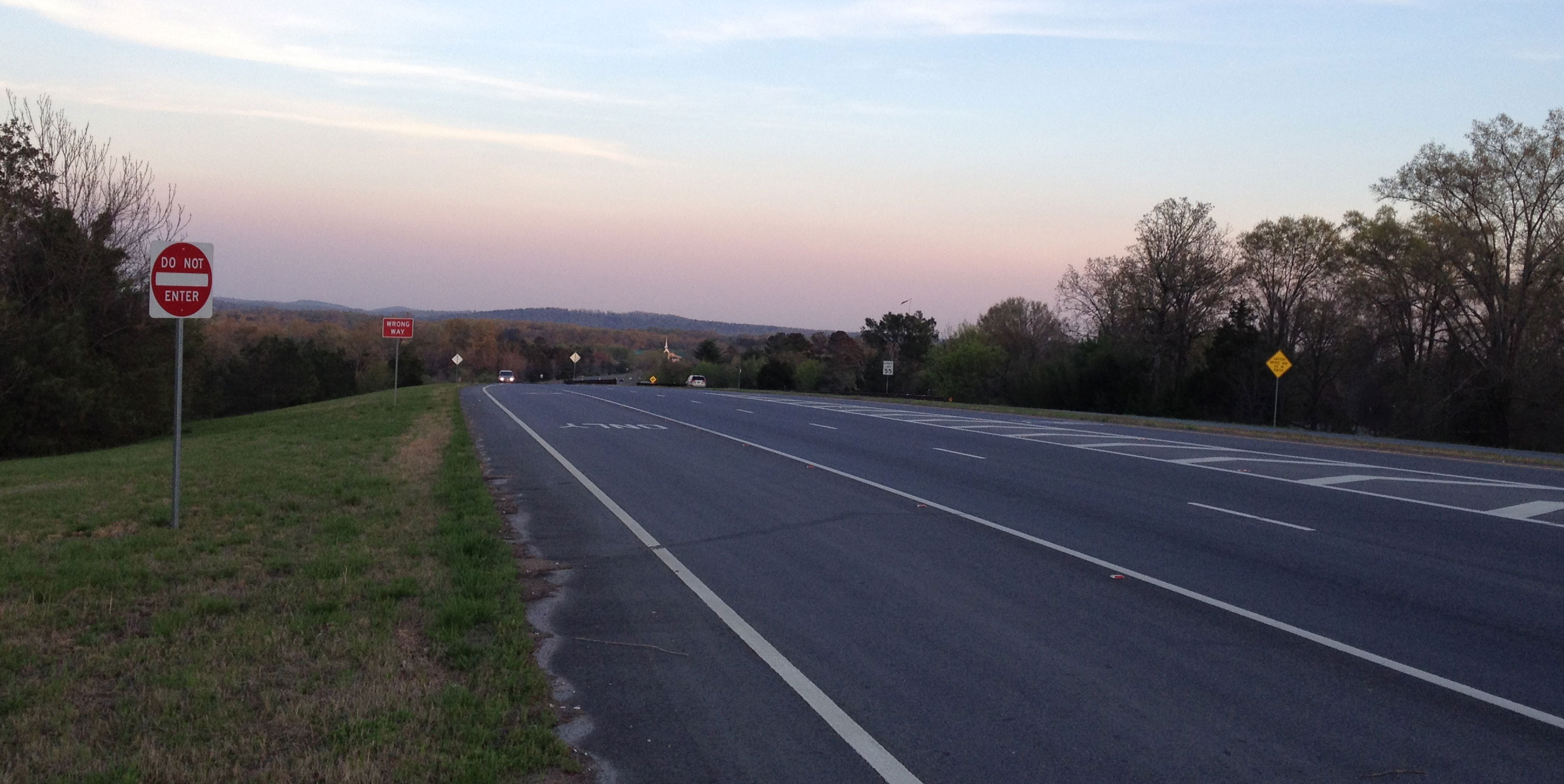
The Twin Cedars and US Highway 27 intersection is dangerous. Relatively heavy and fast traffic on 27, with poor lines of sight due to hills, dips and turns, makes left turns and crossing from the secondary roads very dangerous. Numerous accidents and fatalities support the argument for traffic controls at the intersection.
The current, narrow rights of way on Twin Cedars and Lee Clarkson cannot handle tractor-trailers, and will not accommodate turn lanes. Common thought favors expensive and extensive intersection improvements that will require re-zoning, property condemnation, state and county right-of-way expansion and heavy construction. However, none of this is necessary, and there is an existing and reasonable alternative.
There is no need for a traffic signal at Twin Cedars/27. There is no need for turn lanes on Twin Cedars and Lee Clarkson. I use that intersection every weekday for my commutes, and nearly every weekend to visit Chickamauga. However, I never turn left, and I never directly cross 27.
The safest current method is to never turn left, and never directly cross 27 from Twin Cedars or Lee Clarkson. It is much safer to only turn right from Twin Cedars and Lee Clarkson. That may sound stupid and restrictive, but it makes sense if you use Farming Rock Rd to make left turns. Farming Rock has much better lines of sight on 27, and has much better ingress/egress for turns.
To turn left toward Rock Spring from Twin Cedars:
either Use Farming Rock and Lee Clarkson,
or Take Long Hollow and Kay Conley. Those routes may add one minute to the drive time, but they are far safer.
To cross 27 from Twin Cedars:
Turn right on 27, left on Farming Rock, right on Lee Clarkson.
To cross 27 from Lee Clarkson:
Turn left on Farming Rock, right on 27, left on Twin Cedars.
My suggestion for intersection improvement:
Add signage, striping and pavement arrows only.
Dangerous Intersection signs on Hwy 27
Right Turn Only on Twin Cedars
Right Turn Only on Lee Clarkson
Detour on Farming Rock Rd to Lee Clarkson Rd & vice-versa
Why make Twin Cedars Rd and Lee Clarkson Rd “right turn only”?
This alternative would be a tiny fraction of the monetary and political costs of major construction for lanes and signals. It would solve the safety issues, and improve traffic flow. US Highway 27 traffic could still turn left, but Twin Cedars and Lee Clarkson should be made “right turn only” onto Hwy 27.
Property owners who have been approached by Tennessee Valley Authority (TVA), Georgia Power, North Georgia Electric Membership Corporation (NGEMC), Georgia Transmission Corporation, Oglethorpe Power Corporation or a government representative, and offered any amount for purchase of easement or real estate, have experienced the first step in a process which may end in exercise of eminent domain: the condemnation and compulsory forfeiture or sale of the easement or property.
Example: Church is offered $1.00 (one dollar) for a portion of church property, to build a transmission facility. Church members reject the offer. Power corporation counters with a more realistic monetary offer. The church again refuses. The property is condemned, seized and sold to the power corporation at “fair market value”. Real estate, appraisal or legal fees incurred by the church to affect or resist this process are not recoverable.
While the owners of property on which transmission facilities or lines would be located may receive “fair market value” for the use or loss of their property, nearby property owners will not receive compensation for effects of the project on their property value.
Judging by recent projects, TVA, Georgia Power or Oglethorpe Power eminent domain process will entail a few hours of public meetings, likely on a single day. This will be the primary forum for voicing concerns and objections to the proposed project and the eminent domain process.
How much is your property worth? If the Georgia Department of Transportation (DOT), TVA, NGEMC, Georgia Power, Oglethorpe Power, a city, a county, or the State decides to take your land in a condemnation process, you are entitled to just compensation. Just compensation is rarely achieved on the first offer from the condemning authority.
Landowner rights: If you are a landowner, if you own commercial, residential, or farm property that the DOT, Georgia Power, Oglethorpe Power, TVA, NGEMC or the government requires, speak to an attorney to protect your rights.
Condemnation proceedings: When your land or other real property is subject to a condemnation proceeding to make way for other uses (an interstate highway, a power line right-of-way, or other public uses), an attorney can help you determine an appropriate response.
Similar to the proposed Catoosa substation and transmission project, Georgia Power has a project in the Gainesville area, for which the right of eminent domain may be exercised.
Georgia Power will hold public meetings, as required by O.C.G.A. 22-3-160.1, at the following times and place: Wednesday, September 24, 2014 from 2:00 PM to 4:00 PM and 6:00 PM to 7:30 PM Location: Brenau University Downtown Center 301 Main Street, SW Gainesville, Georgia, 30501
Georgia Power will hold public meetings, as required by O.C.G.A. 22-3-160.1, at the following times and place: Wednesday, September 24, 2014 from 2:00 PM to 4:00 PM and 6:00 PM to 7:30 PM Location: Brenau University Downtown Center 301 Main Street, SW Gainesville, Georgia, 30501
Does this proposal require the use of eminent domain in order to acquire any right-of-way for this project? How many landowners or homeowners will be impacted by the use of eminent domain, what specific lands would be acquired and where are they located?
How has safe, renewable energy been factored into the mix for this expansion of the electric grid?
How would residents and property owners be protected from impacts to property values, property use, human health, environment, scenery, traffic congestion and other concerns?
Why does this area require a new substation and new transmission lines? Why can’t the substation be located at an industrial park? Why bring in power from other areas, when existing North Georgia Electric Membership Cooperative providers, electric infrastructure, corridors and lines could be used?
Oglethorpe Power recently brought 2 large plants online: Hammond (Rome) and Smith (Dalton). NGEMC has purchased power from TVA up to this point. Is this a move by Oglethorpe to expand its member system? Is NGEMC planning to switch from TVA to Oglethorpe as a provider?
We recognize that the country’s power grid is 50 years behind where it should be. How can we be sure this project is urgently needed and that it would be planned and executed in the best possible way?
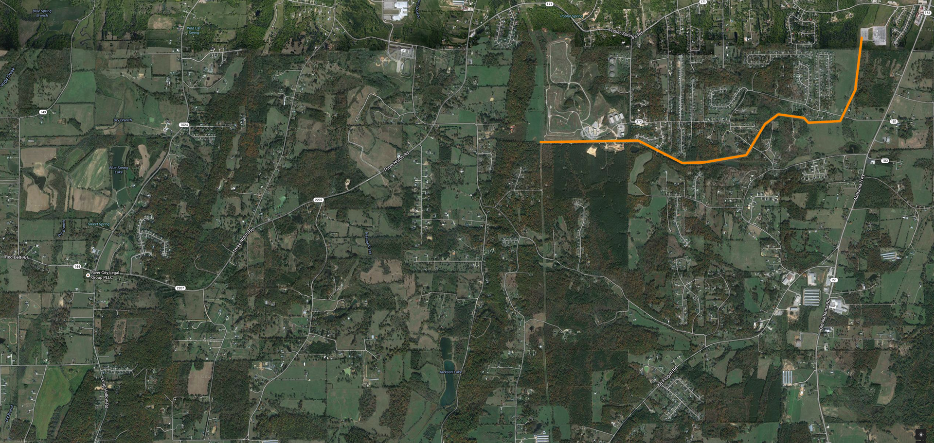
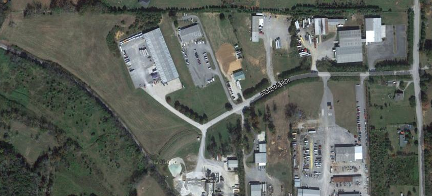
The large residential and industrial areas this substation would serve are located on or over the Walker county line. Why can’t this substation be sited in Walker county? Why can’t it be located in an existing industrial zone, or abandoned/unproductive agricultural land? Why can’t transmission lines use the existing corridors?
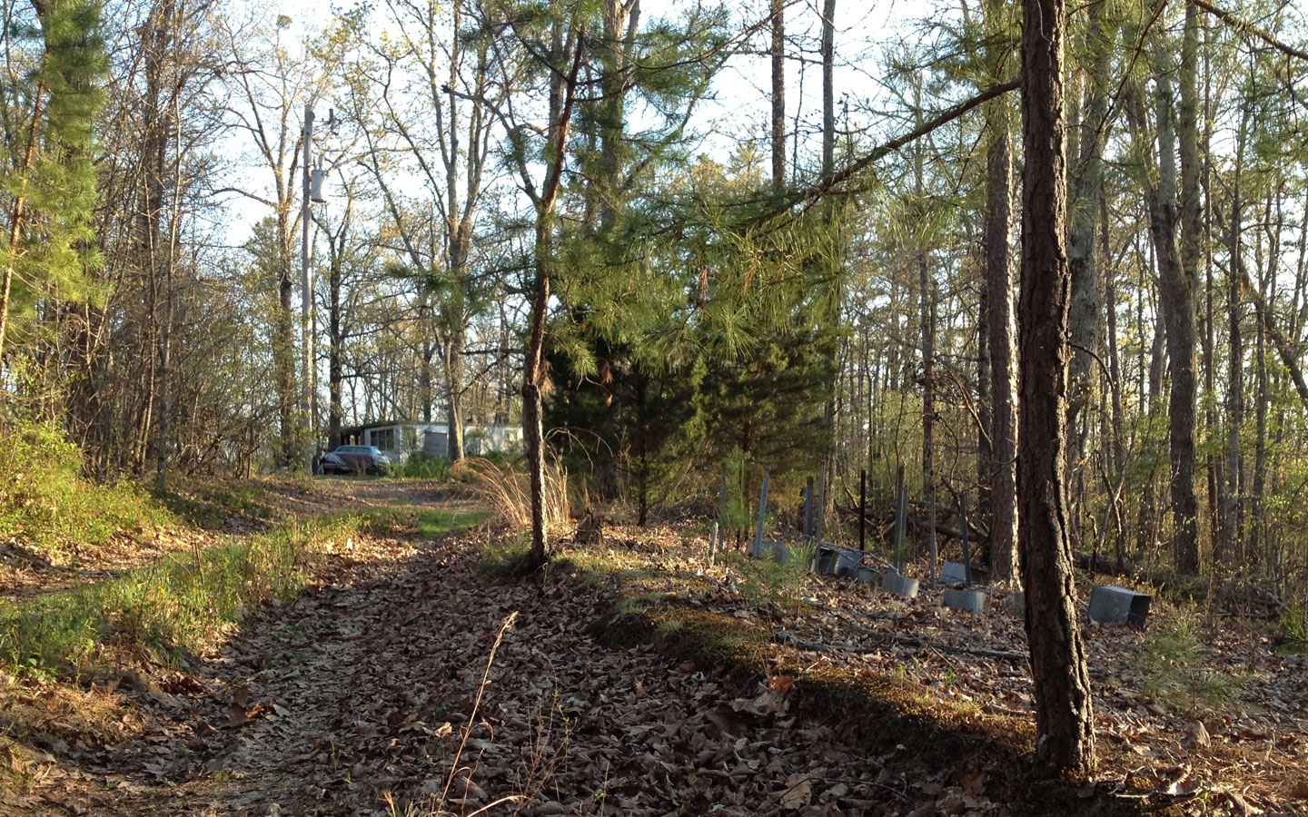
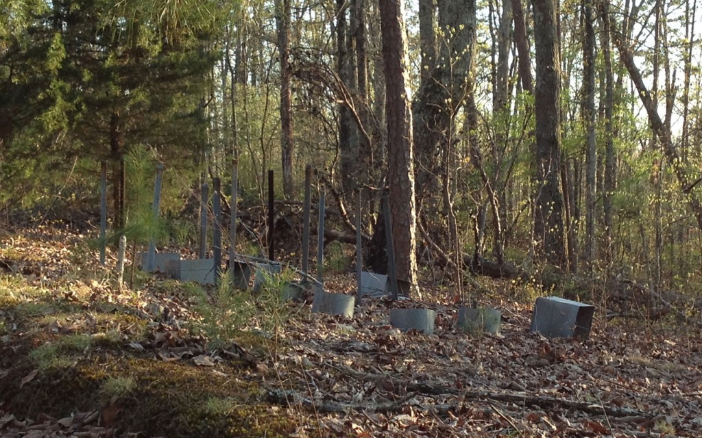
Unproductive agricultural land with existing transmission/distribution ROW
The citizens of this immediate area have often objected to rezoning, inappropriate development, and inadequate infrastructure planning, but the county and state have (just as often) brushed off these objections. Politicians and officials have stated property values would remain steady, taxes would not increase, and infrastructure would be sufficient to support new development. Why should citizens believe the state and county governments?
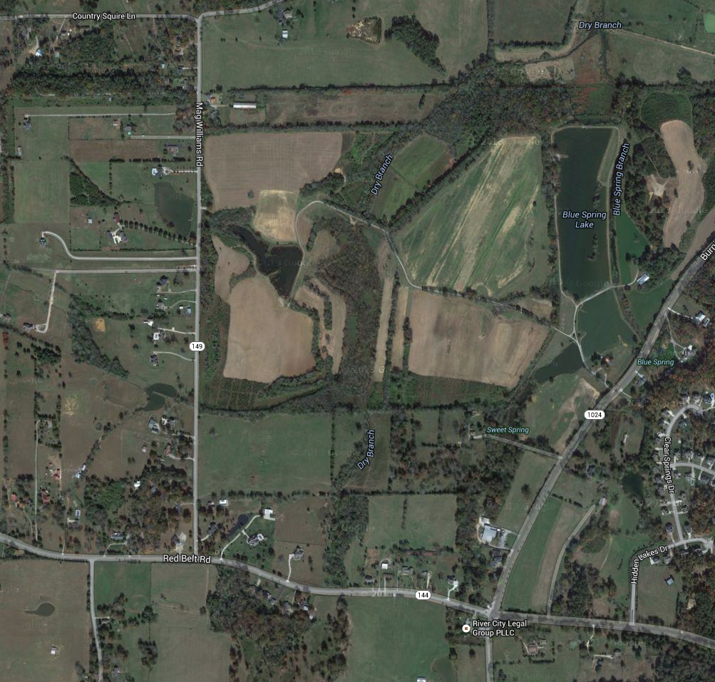
This area is one of the last remaining sections of the county with large areas of productive farmland and pasture. If a substation is built, will it lead to rapid suburban development? Will there be large transmission towers and lines leading in all directions?
Why should citizens accept yet another assault on their cultural and property values? Why should they believe the politicians and officials who are supporting this project?
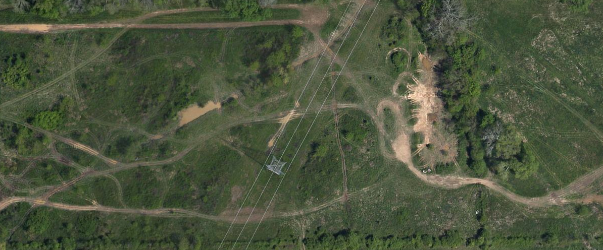
Industrial site with existing transmission/distribution ROW
Why is this facility not planned for location on existing powerlines (expansion) or power corridors (co-location)? Why not choose an industrial location, or abandoned/unused agricultural parcels, instead of ruining prime, productive farmland and impacting a beautiful rural landscape?
With the nearby sinkholes and springs, how can the proposed site be stable and safe enough to support such a large facility? How can the state and utilities guarantee there will never be groundwater pollution, or further impairment to Chickamauga Creek, from an accident at the facility?
Area proposed for substation and new transmission/transfer facilities: prime, productive farmland mixed with residential. Springs, groundwater, and surface lakes.
The roads in this area are not capable of handling additional traffic, and are not safe for motorists, pedestrians or cyclists. This area has seen too much sprawling residential development in the past, and it does not have the sidewalks, turning lanes, drainage or other amenities and infrastructure to handle additional development.
Economics may lead to this project failing to get built, or being unnecessary. Walker County wants to develop a huge industrial park, and more residential zones in Rock Spring and Kensington. They are now asking to raise citizens’ taxes, while simultaneously offering real estate and tax incentives to prospective employers and developers.
What proposed or planned development is contingent upon this new infrastructure? Who stands to financially benefit from the project (power producers, contractors and/or developers)?
Why should Catoosa citizens bear the external cost of this project? Will Catoosa and the state be hunting for tax increases as well? Why should current residents, landowners and citizens pay the bills for economic speculation by the counties and the state?
Image: Electricity Sub-Station; Sub-Station south of Maybole with transmission line running to the east
GA House Bill 176, titled “Mobile Broadband Infrastructure Leads to Development (BILD) Act“ limits the oversight that local governments and citizens exercise in the permitting process for cell towers.
This bill passed house and senate, and went to Governor Nathan Deal’s desk on March 24. The governor signed the bill April 21, so it is now Georgia state law.
111 (c) [& following...] A local governing authority's review of an application to modify or collocate wireless facilities on an existing wireless support structure shall not include an evaluation of the technical, business, or service characteristics of such proposed wireless facilities. A local governing authority shall not require an applicant to submit radio frequency analyses or any other documentation intended to demonstrate the proposed service characteristics of the proposed wireless facilities, to illustrate the need for such wireless facilities, or to justify the business decision to collocate such wireless facilities; provided, however, that the local governing authority may require the applicant to provide a letter from a radio frequency engineer certifying the applicant's proposed wireless facilities will not interfere with public safety emergency communications.
Without this oversight, citizens and local government could be unable to request:
the environmental effects of wireless microwave transmission
business justification for placement of wireless facilities, such as “to fill a dead zone in our coverage map”
Support for the objections to the proposed cell tower site.
According to approximate measurements using the online tools on the Catoosa County Parcel Maps website, the proposed tower site is less than 1,000 feet from existing residences.
The visual impact of the cell tower would be severe.
Napier Ridge or Watoosa Ridge is prominent , and can be seen from Chickmauga and Chattanooga National Military Park (the Battlefield), Chickamauga, Ringgold, Rock Spring, Lookout Mountain and Lafayette. A 189′ tower would be higher above the ridge line than the 150′ ridge is above the surrounding area.
There are currently no cell towers on the ridge; many local residents will prefer to keep the view they already enjoy.
Excellent cell coverage for the area is already provided by the 300′ tower (“big pine tree”) on the US 27 Bypass in Chickamauga, and rural towers in Noble and Rock Spring, Georgia.
Hwy 27 Bypass at Osborn Rd in Chickamauga. Napier/Watoosa Ridge is directly ahead on the horizon (click to enlarge)
Below are photos of cell towers near the Walker county line in St Elmo (Hamilton County, TN). This ridge is similar in height to Watoosa/Napier Ridge.
Click below to enlarge and/or view full size images…
Cell towers in St Elmo, near the Walker county line
Cell towers in St Elmo, near the Walker county line
Cell towers in St Elmo, near the Walker county lineCell towers in St Elmo, near the Walker county line
Cell towers in St Elmo, near the Walker county line
Cell towers in St Elmo, near the Walker county line
Cell towers in St Elmo, near the Walker county line
Cell towers in St Elmo, near the Walker county line
Cell towers in St Elmo, near the Walker county line
Proposed cell tower would be on the Catoosa & Walker County line
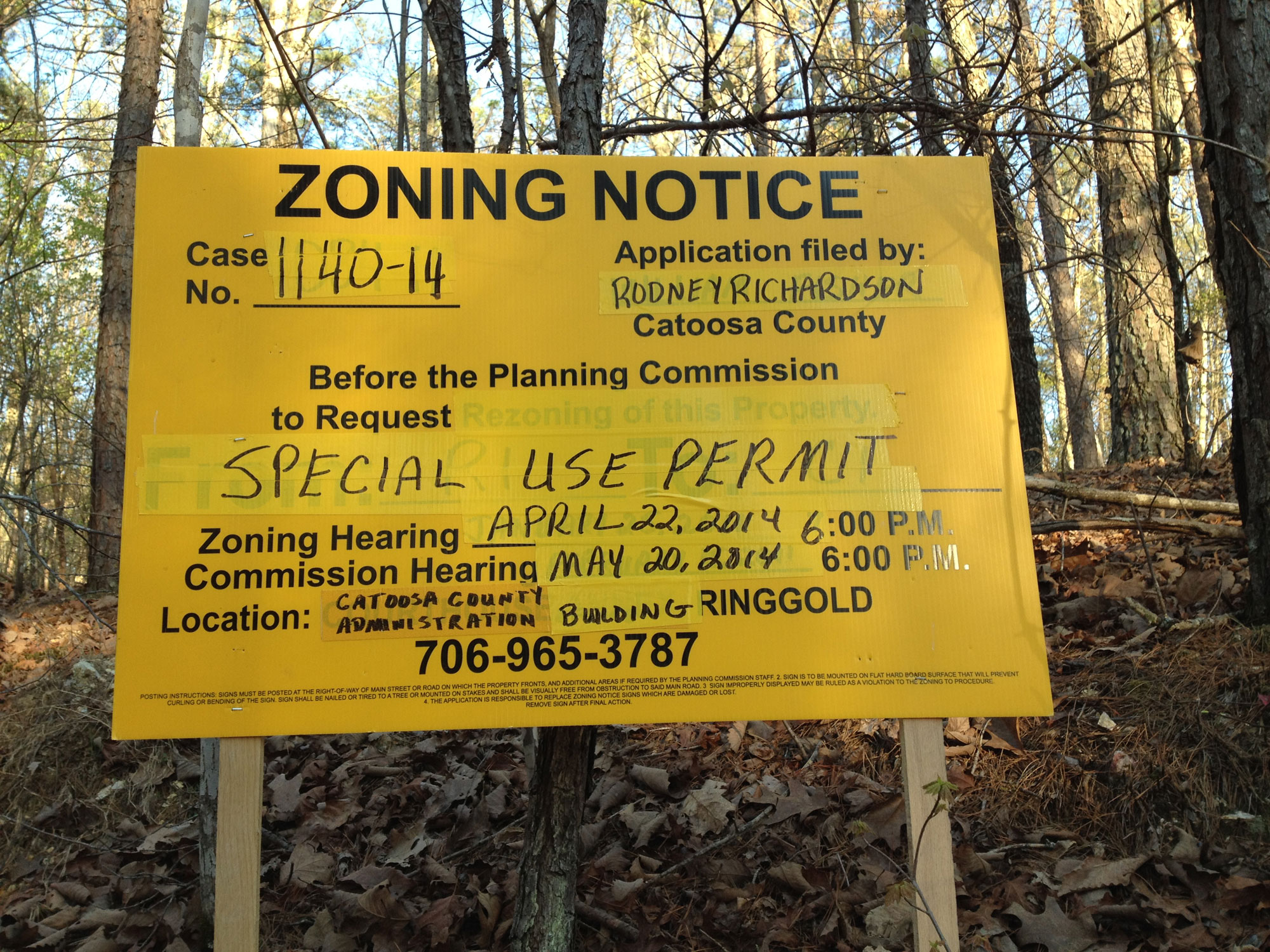
Rodney Richardson has applied for a Special Use Permit to allow a cellular communications tower to be constructed and operated in Catoosa County, GA near the Walker County line, near Long Hollow Road.
Please plan to attend the following meetings to oppose this nuisance, property value killer, and eyesore:
Zoning Hearing
April 22, 2014 at 6:00 PM
Catoosa County Administration Bldg.
800 Lafayette Rd, Ringgold, GA more info and map →
Commission Hearing
May 20, 2014 at 6:00 PM
800 Lafayette Rd, Ringgold, GA more info and map →
For more information about the Special Use Permit, hearings, etc:
call 706-965-3787
Ask for zoning information about Case No. 1140-14.
The company that plans to build the tower contacted several local property owners during 2013-14, but these neighbors refused to consider the offer. These are landholders who either reside on their land, or who care about the value(s) of their land and their community.
Information about Cell Phone Towers
(potential health hazards of Electromagnetic Radiation)
Cell Tower Permit Applied for in Catoosa County, Georgia; proposed tower on property at the Walker County line.
A 189′ tall cell tower would be placed at the top of Napier/Watoosa ridge, and would be visible for miles in all directions.
This permit application affects anyone who lives or travels within view of Napier Ridge (Watoosa Ridge), near the Catoosa and Walker County lines in Georgia.
Because the Special Use Permit would require a variance from current Catoosa County, Georgia law, it directly affects ALL Catoosa residents.
Because the cell tower would be located on property at the Walker County line, it would directly affect many Walker residents.
Please study the maps on this page for more information.
Walker County residents are free to comment on this Catoosa County permit application, because a cell tower would impact the surrounding area. Read More: What Can We Do? →
Where can I find information about the property owner?


